$2,155,361
Fundo 165 Ha Km 1050 Ruta 5 Sur
- Aktualisiert: August 13
-
8
Ansichten der letzten 30 Tage
- 9
Über die Immobilie
Beschreibung wurde automatisch übersetzt.
Die Beschreibung wird in der Originalsprache angezeigt.
Ein 165 Hektar großes Grundstück auf der rechten Seite (Nord-Süd) der Schnellstraße Route 5, 42 km südlich der Regionalhauptstadt Puerto Montt und 13 km nördlich des Chacao-Kanals und der zukünftigen Brücke, die zur Insel Chiloé führen wird. Projekt mit genehmigter Unterteilung, registriert im CBR, mit fertiggestellten Innenstraßen. Es zeichnet sich durch klar definierte Grenzen aus; im Osten ist
A 165-hectare property located on the right-hand side (north-south) of the Route 5 dual carriageway; 42 km south of the regional capital of Puerto Montt and 13 km north of the Chacao Channel and the future bridge that will cross to Chiloé Island.
The project has an approved subdivision plan registered with the Land Registry (CBR), and the internal roads are completed.
It is chara
The project has an approved subdivision plan registered with the Land Registry (CBR), and the internal roads are completed.
It is chara
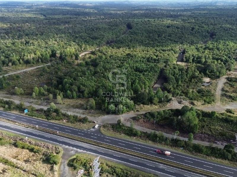
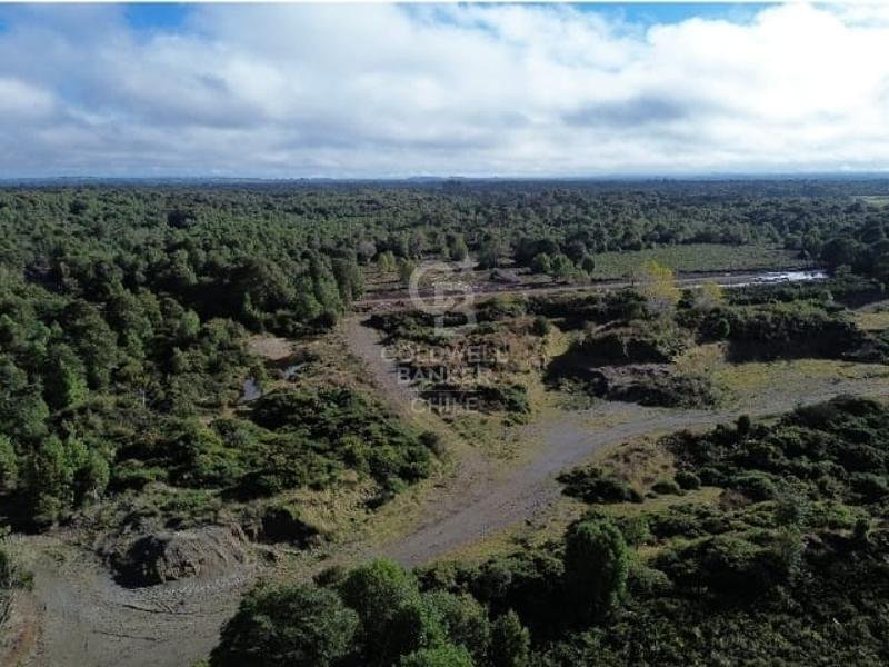
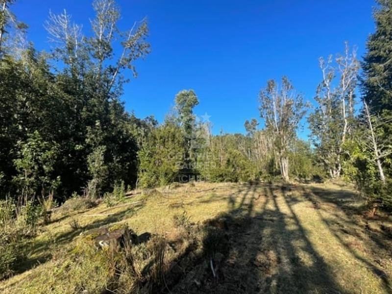
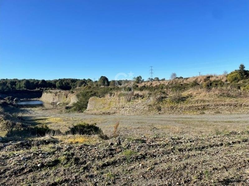
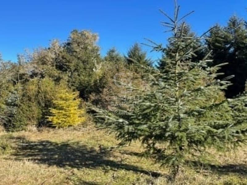
Ein 165 Hektar großes Grundstück auf der rechten Seite (Nord-Süd) der Schnellstraße Route 5, 42 km südlich der Regionalhauptstadt Puerto Montt und 13 km nördlich des Chacao-Kanals und der zukünftigen Brücke, die zur Insel Chiloé führen wird. Projekt mit genehmigter Unterteilung, registriert im CBR, mit fertiggestellten Innenstraßen. Es zeichnet sich durch klar definierte Grenzen aus; im Osten ist es etwa 1.200 Meter lang auf eine zweispurige Fahrbahn ausgerichtet und hat zwei ganzjährig fließende Bäche, einen im Norden und einen im Süden des Grundstücks. Es verfügt über eine 2 Hektar große Sammelgrube, die genutzt und bei Bedarf vergrößert werden könnte. Was die Stromversorgung anbelangt, so gibt es eine dreiphasige Stromleitung, die von Norden nach Süden entlang der 1.200 Meter langen Ostgrenze verläuft. Dieses Gebiet ist durch erhebliche Grundwasserflüsse gekennzeichnet, die bis zu einer Tiefe von etwa 30 Metern reichen. Der Verkaufswert bezieht sich auf die gesamte Immobilie.
A 165-hectare property located on the right-hand side (north-south) of the Route 5 dual carriageway; 42 km south of the regional capital of Puerto Montt and 13 km north of the Chacao Channel and the future bridge that will cross to Chiloé Island.
The project has an approved subdivision plan registered with the Land Registry (CBR), and the internal roads are completed.
It is characterized by well-defined boundaries; to the east, it has approximately 1,200 meters of frontage on the dual carriageway and two streams with year-round flow, one to the north and one to the south of the property.
It has a 2-hectare gravel pit, which could be exploited and expanded if necessary.
Regarding utilities, it has a three-phase power line running north-south along the 1,200 meters of the eastern boundary. This area is characterized by a significant amount of groundwater, reaching depths of approximately 30 meters.
The sale price is for the entire property.
The project has an approved subdivision plan registered with the Land Registry (CBR), and the internal roads are completed.
It is characterized by well-defined boundaries; to the east, it has approximately 1,200 meters of frontage on the dual carriageway and two streams with year-round flow, one to the north and one to the south of the property.
It has a 2-hectare gravel pit, which could be exploited and expanded if necessary.
Regarding utilities, it has a three-phase power line running north-south along the 1,200 meters of the eastern boundary. This area is characterized by a significant amount of groundwater, reaching depths of approximately 30 meters.
The sale price is for the entire property.
-
Art der Immobilie
Land
Funktionen
- Garten
- Bergblick
Erkunden Sie die Gegend
Costado derecho de la doble vía Ruta, Puerto Montt, Los Lagos, Chile
Auf Google Maps anzeigen
Preis pro sqft
Niedrig
Hoch
Vor 3 Jahren beigetreten
Sie haben sich nach diesem Objekt erkundigt
Der Agent wird sich in Kürze mit Ihnen in Verbindung setzen
Gelistet von
45
Angebote
2023
Beigetreten
Besichtigung mit the agent buchen
Wählen Sie ein Datum und ob Sie eine virtuelle oder persönliche Besichtigung mit dem Makler wünschen.
Bevorzugtes Datum
Art der Tour

Coldwell Banker Los Lagos - Los Lagos
Km 1.5 Camino Ensenada, Los Lagos, Los Lagos, Chile
Agenturprofil anzeigen
Zuletzt aktualisiert
August 13
Erstmalig gelistet
May 31, 2025
Angebotsreferenz
h4d9k6
Ähnliche Immobilien in der Nähe
Neue Angebote in Puerto Montt

Entdecken Sie mehr Häuser zum Verkauf
Puerto Montt, Chile Immobilienarten
Puerto Montt, Chile beliebte Suchanfragen
- Immobilien mit Wasserblick in Puerto Montt, Chile
- Immobilien mit Meerblick in Puerto Montt, Chile
- Panorama Immobilien in Puerto Montt, Chile
- Immobilien mit Kamin in Puerto Montt, Chile
- Immobilien mit Whirlpool in Puerto Montt, Chile
- am Wasser Immobilien in Puerto Montt, Chile
- Immobilien mit Sauna in Puerto Montt, Chile
- Pferdesport Immobilien in Puerto Montt, Chile
- Immobilien mit Terrasse in Puerto Montt, Chile
Verwandte Leitfäden & Geschichten
Das Vertrauen der führenden Makler der Welt
Die Makler hinter den außergewöhnlichsten Immobilien der Welt inserieren bei JamesEdition.
- Angebote von Sotheby's, Christie's, BARNES und Engel & Völkers
- Jedes Angebot wird vor der Veröffentlichung geprüft
- Verbinden Sie sich direkt mit verifizierten Maklern
Indem Sie fortfahren, akzeptieren Sie unsere Nutzungsbedingungen und Datenschutzrichtlinie.