$8,418,065
Terreno Con Progetto Approvato Ad Alcobaça Leiria
- 37.55 Ac lot
- Aggiornato: Novembre 26, 2025
-
3
Visualizzazioni degli ultimi 30 giorni
- 1
Informazioni sulla proprietà
La descrizione è stata tradotta automaticamente.
La descrizione viene visualizzata nella lingua originale.
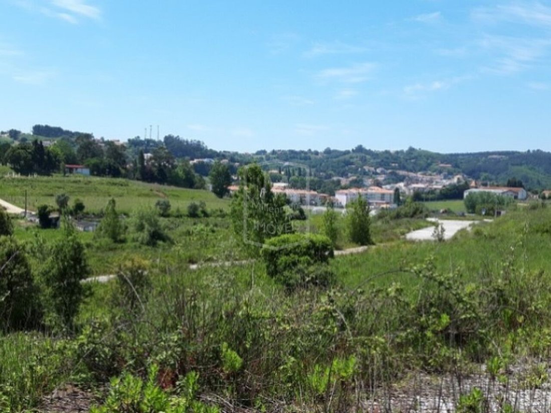
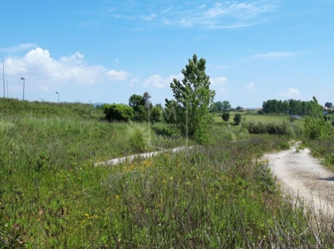
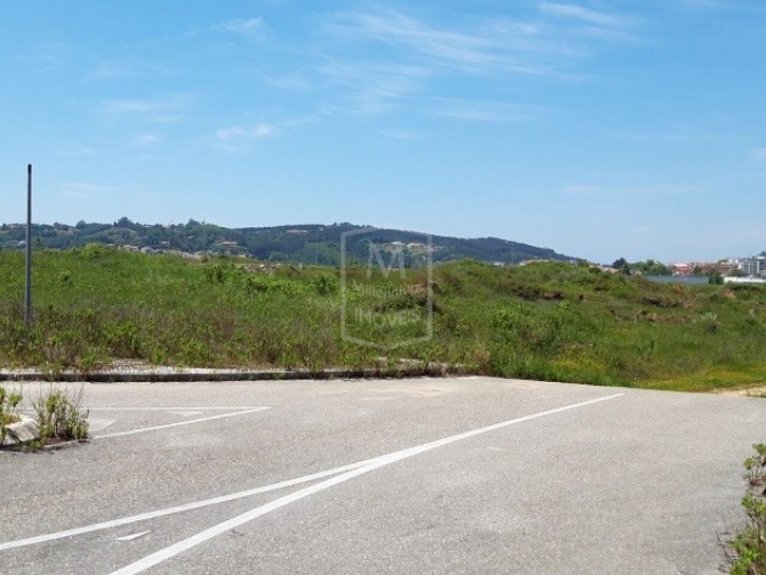
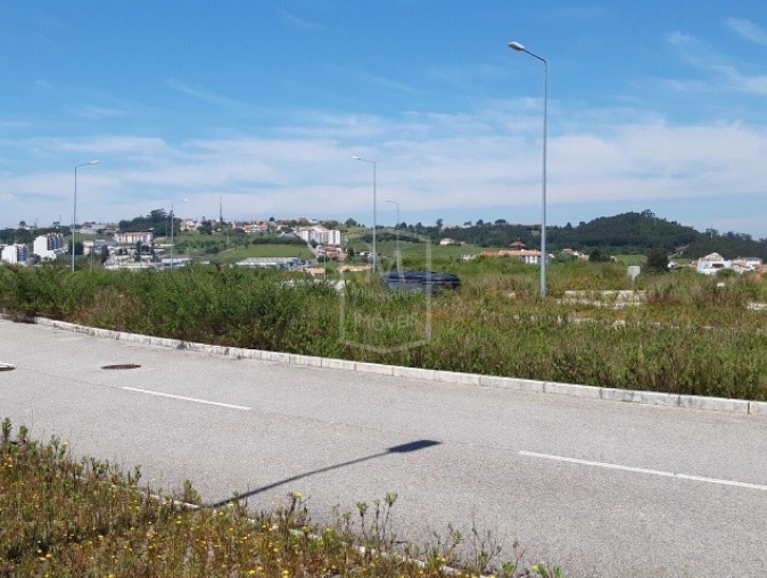
Importante lotto con Alcobaça i cui lavori di urbanizzazione sono stati approvati dal CMA, per abitazioni (unifamiliari e plurifamiliari), commercio e servizi, con una superficie lorda di costruzione totale (ABC) di 151.950 mq. Classe energetica: esente L’attuale città di Alcobaça è cresciuta nelle valli del fiume Alcoa e del fiume Baça. L’area dell’attuale comune di Alcobaça era abitata dai roman
Important allotment with Alcobaça whose urbanization works were approved by the CMA, for housing (single-family and multi-family), commerce and services, with a total Gross Construction Area (ABC) of 151,950sqm. Energy Class: Exempt The current city of Alcobaça has grown in the valleys of the Alcoa River and the Baça River. The area of the current municipality of Alcobaça was inhabited by the Roma
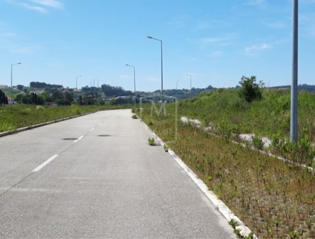
Importante lotto con Alcobaça i cui lavori di urbanizzazione sono stati approvati dal CMA, per abitazioni (unifamiliari e plurifamiliari), commercio e servizi, con una superficie lorda di costruzione totale (ABC) di 151.950 mq. Classe energetica: esente L’attuale città di Alcobaça è cresciuta nelle valli del fiume Alcoa e del fiume Baça. L’area dell’attuale comune di Alcobaça era abitata dai romani, ma la denominazione le è stata lasciata dagli arabi, la cui occupazione denota un’era di progresso a giudicare dai numerosi toponimi delle terre adiacenti che li ricordano, come Alcobaça, Alfeizerão, Aljubarrota, Alpedriz e altri toponimi. Quando Alcobaça fu riconquistata, la località aveva accesso al vicino mare che formava la grande laguna di Pederneira che raggiungeva Cós e consentiva loro di navigare sulle navi che trasportavano nel resto del paese i deliziosi frutti prodotti nella regione grazie alla tecnica introdotta dai monaci di Cisterer. Afonso Henriques addolcì le Terre di Alcobaça ai monaci cistercensi l’8 aprile 1153, con l’obbligo di ruttarli; le donazioni fatte durante i vari regni arrivarono a costituire un vasto territorio - I Coutos di Alcobaça - che si estendeva da São Pedro de Moel a São Martinho do Porto e da Aljubarrota ad Alvorninha, e il territorio raggiunse raggiunse il massimo durante il regno di D. Fernando I. I monaci cistermeni divennero signori di 14 villaggi di cui 4 erano porti marittimi: Alfeizerão, São Martinho do Porto, Pederneira e Paredes da Vitória. I monaci di Alcobaça, oltre alla loro attività religiosa e culturale, hanno avuto classi pubbliche dal 1269 e in esse, oltre a discipline umanistiche, logiche e teologia, hanno insegnato tecniche agricole - hanno sviluppato un’azione colonizzatrice notevole e duratura, mettendo in pratica le innovazioni agricole sperimentate in altri monasteri e grazie alle quali hanno ruttato le terre, essiccato bastoncini, introdotto culture adatte a ogni terra e organizzato fattorie o fattorie, quelle che chiamavano fattorie, creando praticamente dal nulla una regione agricola che è rimasta fino ad oggi è una delle più produttive del Portogallo. Joaquim Vieira Naatividade si riferisce ai monaci di Alcobaça, come ai monaci-agronomi. I comuni di Alcobaça e Nazaré, così come parte del comune settentrionale di Caldas da Rainha, furono ruttati e amministrati dai monaci di Alcobacense. Questo vasto territorio era chiamato Coutos de Alcobaça. (rif. AV-PBI-1253)
Important allotment with Alcobaça whose urbanization works were approved by the CMA, for housing (single-family and multi-family), commerce and services, with a total Gross Construction Area (ABC) of 151,950sqm. Energy Class: Exempt The current city of Alcobaça has grown in the valleys of the Alcoa River and the Baça River. The area of the current municipality of Alcobaça was inhabited by the Romans, but the denomination was left to it by the Arabs, whose occupation denotes an era of progress judging by the numerous toponyms of the adjacent lands that remind them, such as Alcobaça, Alfeizerão, Aljubarrota, Alpedriz and other toponyms. When Alcobaça was reconquered, the locality had access to the nearby sea that formed the great Pederneira Lagoon that reached Cós and allowed them to sail the vessels that transported to the rest of the country the delicious fruits produced in the region thanks to the technique introduced by the monks of Cisterer. Afonso Henriques sweetened the Lands of Alcobaça to the Cistercian monks on April 8,1153, with the obligation to burp them; the donations made over the various reigns came to constitute a vast territory - The Coutos of Alcobaça - ranging from about São Pedro de Moel to São Martinho do Porto and from Aljubarrota to Alvorninha, and the territory reached its maximum in the reign of D. Fernando I. The monks of Cistermen came to be lords of 14 villages of which 4 were sea ports: Alfeizerão, São Martinho do Porto, Pederneira and Paredes da Vitória. The monks of Alcobaça, in addition to their religious and cultural activity- have had public classes since 1269 and in them, in addition to Humanities, Logic and Theology, taught agricultural techniques - developed a remarkable and lasting colonizing action, putting into practice the agricultural innovations experienced in other monasteries and thanks to which they burped the lands, dried sticks, introduced cultures suitable to each land and organized farms or farms, what they called farms, creating practically from nothing an agricultural region that has remained to this day as one of the most productive in Portugal. Joaquim Vieira Naatividade refers to the monks of Alcobaça, as the monks-agronomes. The municipalities of Alcobaça and Nazaré, as well as part of the northern municipality of Caldas da Rainha, was burped and administered by the Alcobacense monks. This vast territory was called the Coutos de Alcobaça. (ref AV-PBI-1253)
-
Tipo di proprietà
Terreno
Caratteristiche
Esplora la zona
Alcobaca e Vestiaria, Distretto di Leiria, Portogallo
Visualizza su Google Maps
Prezzo per sqft
Basso
Alto
Iscritto da 3 anni
Hai chiesto informazioni su questa proprietà
L'agente La contatterà al più presto
Pubblicato da
82
Annunci
2023
Iscritto
Prenota una visita con the agent
Scegli una data e indica se preferisci un tour virtuale o di persona con l’agente.
Data preferita
Tipo di tour
Ultimo aggiornamento
Novembre 26, 2025
Prima pubblicazione
May 19, 2023
Riferimento annuncio
-209578524
Proprietà simili nelle vicinanze
Nuovi annunci a Alcobaca e Vestiaria

Esplora più immobili in vendita
tipi di proprietà Alcobaca e Vestiaria, Portogallo
- Case in vendita in Alcobaca e Vestiaria, Portogallo
- Case in vendita in Alcobaca e Vestiaria, Portogallo
- Terreno in vendita in Alcobaca e Vestiaria, Portogallo
- Appartamenti in vendita in Alcobaca e Vestiaria, Portogallo
- Ville in vendita in Alcobaca e Vestiaria, Portogallo
- Tenute agricole in vendita in Alcobaca e Vestiaria, Portogallo
Alcobaca e Vestiaria, Portogallo ricerche popolari
- Proprietà immobiliari Vista panoramica / Scenica a Alcobaca e Vestiaria, Portogallo
- Proprietà immobiliari con Terrazza a Alcobaca e Vestiaria, Portogallo
- Proprietà immobiliari con Bar a Alcobaca e Vestiaria, Portogallo
- Proprietà immobiliari con Sala giochi a Alcobaca e Vestiaria, Portogallo
- Proprietà immobiliari con Ufficio a Alcobaca e Vestiaria, Portogallo
- Proprietà immobiliari con Ascensore a Alcobaca e Vestiaria, Portogallo
- Proprietà immobiliari Vista Città a Alcobaca e Vestiaria, Portogallo
- Proprietà immobiliari Vista sulle montagne a Alcobaca e Vestiaria, Portogallo
- Proprietà immobiliari con Giardino a Alcobaca e Vestiaria, Portogallo
- Proprietà immobiliari con Cucina esterna a Alcobaca e Vestiaria, Portogallo
- Proprietà immobiliari Duplex a Alcobaca e Vestiaria, Portogallo
- Proprietà immobiliari Comunità recintata a Alcobaca e Vestiaria, Portogallo
- Proprietà immobiliari Privacy a Alcobaca e Vestiaria, Portogallo
- Proprietà immobiliari Collina a Alcobaca e Vestiaria, Portogallo
- Proprietà immobiliari Investimento immobiliare a Alcobaca e Vestiaria, Portogallo
- Proprietà immobiliari Moderno a Alcobaca e Vestiaria, Portogallo
- Proprietà immobiliari Nuove costruzioni a Alcobaca e Vestiaria, Portogallo
- Proprietà immobiliari con Centro Fitness / Palestra a Alcobaca e Vestiaria, Portogallo
- Proprietà immobiliari con Sauna a Alcobaca e Vestiaria, Portogallo
- Proprietà immobiliari con Aria condizionata a Alcobaca e Vestiaria, Portogallo
- Proprietà immobiliari con Cantina a Alcobaca e Vestiaria, Portogallo
- Proprietà immobiliari con Idromassaggio a Alcobaca e Vestiaria, Portogallo
- Proprietà immobiliari con Camino a Alcobaca e Vestiaria, Portogallo
- Proprietà immobiliari con Piscina a Alcobaca e Vestiaria, Portogallo
- Proprietà immobiliari con Garage a Alcobaca e Vestiaria, Portogallo
- Proprietà immobiliari con Balcone a Alcobaca e Vestiaria, Portogallo
- Proprietà immobiliari con Cucina aperta a Alcobaca e Vestiaria, Portogallo
- Proprietà immobiliari Rinnovato a Alcobaca e Vestiaria, Portogallo
- Proprietà immobiliari Fronte mare a Alcobaca e Vestiaria, Portogallo
- Proprietà immobiliari Vista sull'acqua a Alcobaca e Vestiaria, Portogallo