$788,182
Terrain De 35100m2 Composé De 4 Articles
- 8.68 Ac lot
- Mis à jour: Juin 18
- 6
À propos de la propriété
La description a été traduite automatiquement.
La description est affichée dans la langue d'origine.
Terrain situé dans la paroisse de São Miguel, dans la municipalité de Vila Franca do Campo.
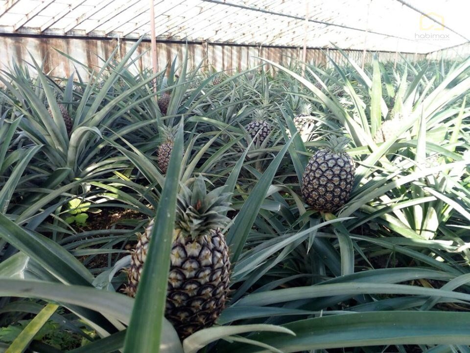
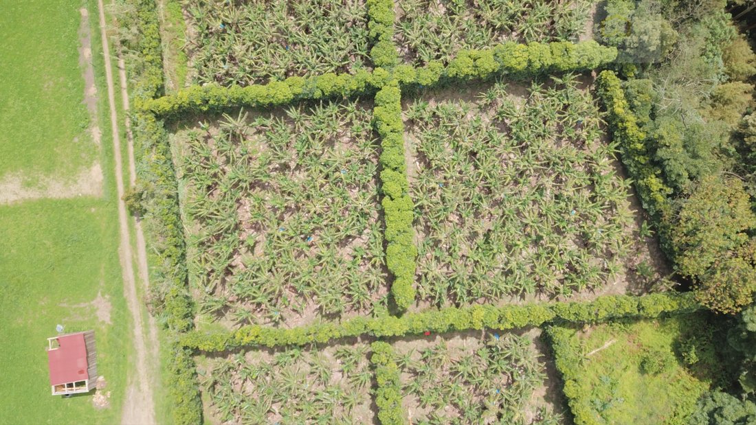
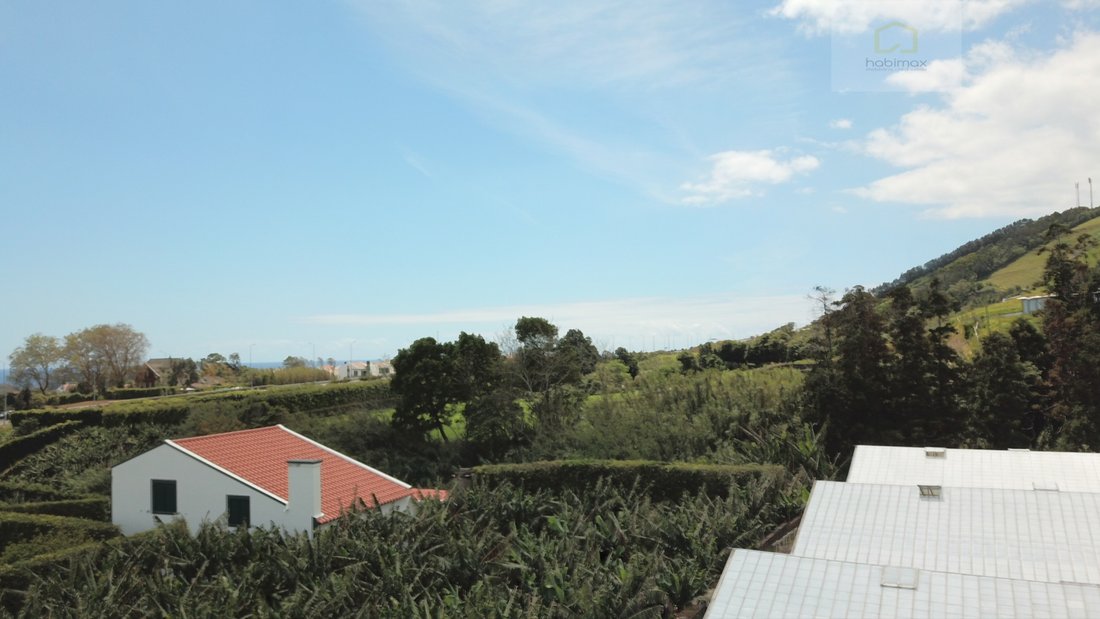
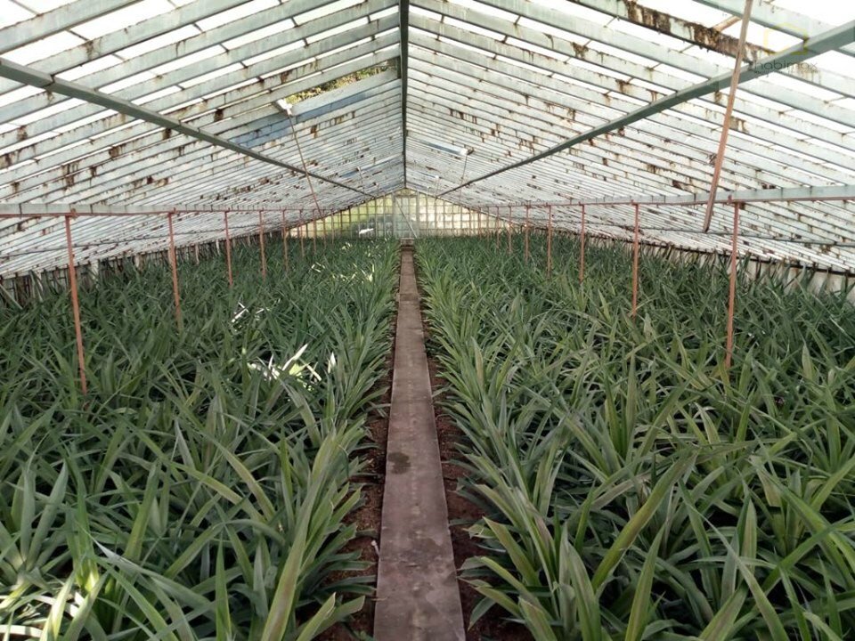
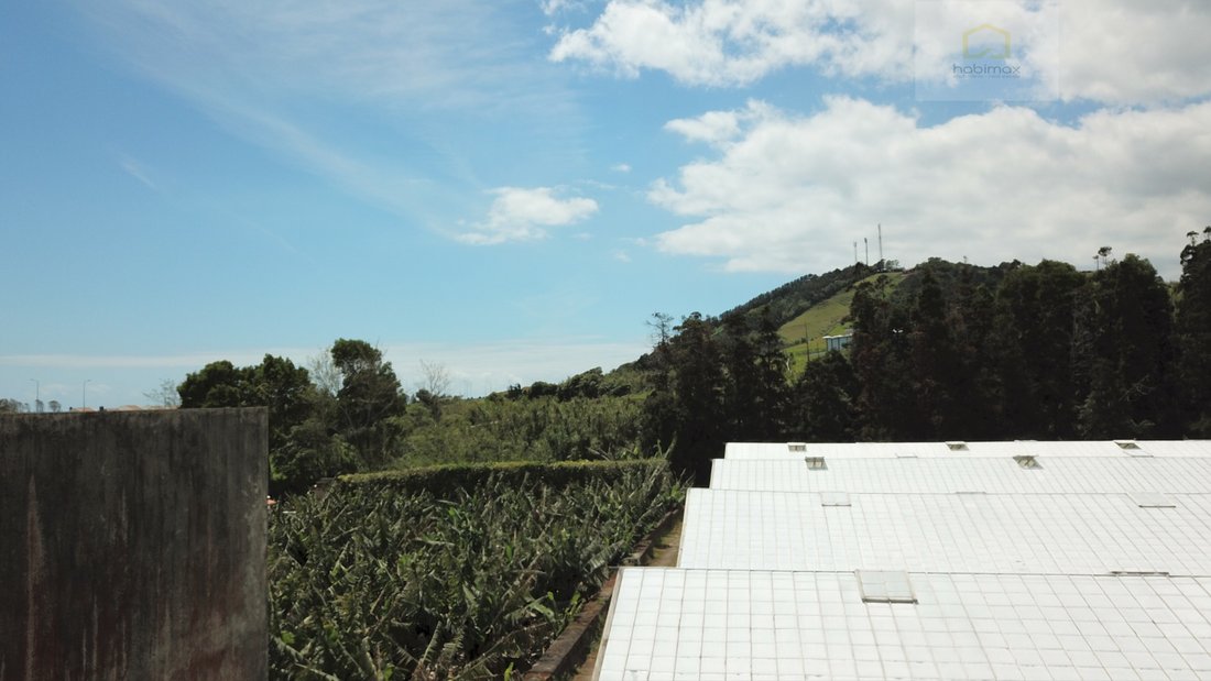
Bâtiment composé de 4 articles d’une superficie totale de 35 100 m2. Le bâtiment possède une dépendance agricole, 4 serres, des lavradia, une petite forêt et sa quasi-totalité est composée de bananiers. Possibilité de construire une villa.
Vila Franca do Campo est un village portugais de
Bâtiment composé de 4 articles d’une superficie totale de 35 100 m2. Le bâtiment possède une dépendance agricole, 4 serres, des lavradia, une petite forêt et sa quasi-totalité est composée de bananiers. Possibilité de construire une villa.
Vila Franca do Campo est un village portugais de
Land located in the parish of São Miguel in the municipality of Vila Franca do Campo.
Building composed of 4 articles with a total of 35,100 m2. The building has an agricultural dependency, 4 greenhouses, lavradia land, small forest and its almost totality is banana. Possibility of building a villa.
Vila Franca do Campo is a Portuguese village on the island of São Miguel, Autono
Building composed of 4 articles with a total of 35,100 m2. The building has an agricultural dependency, 4 greenhouses, lavradia land, small forest and its almost totality is banana. Possibility of building a villa.
Vila Franca do Campo is a Portuguese village on the island of São Miguel, Autono
Terrain situé dans la paroisse de São Miguel, dans la municipalité de Vila Franca do Campo.
Bâtiment composé de 4 articles d’une superficie totale de 35 100 m2. Le bâtiment possède une dépendance agricole, 4 serres, des lavradia, une petite forêt et sa quasi-totalité est composée de bananiers. Possibilité de construire une villa.
Vila Franca do Campo est un village portugais de l’île de São Miguel, dans la région autonome des Açores, siège de la petite municipalité de Vila Franca do Campo [2] avec 78,00 km² de superficie et 11 229 habitants (2011), subdivisée en 6 paroisses.
La municipalité est bordée au nord par la municipalité de Ribeira Grande, à l’est par Povoação, à l’ouest par Lagoa et au sud elle a un littoral dans l’océan Atlantique.
Le village est situé à une latitude (téléphone caché) (41’) nord et à une longitude de 2,433 (25°26’) ouest.
En face de Vila Franca do Campo, à environ 1200 m du port de Tagarete, se trouve l’îlot de Vila Franca, un cône côtier de touffes palagonítiques fortement lititifiées, qui contient à l’intérieur une caldeira inondée presque parfaitement circulaire.
L’îlot de Vila Franca est depuis 1993 une réserve naturelle et constitue également un lieu estival important.
Les paroisses de la municipalité de Vila Franca do Campo sont les suivantes : Água de Alto, Ponta Garça, Ribeira das Tainhas, Ribeira Seca, São Miguel (Vila Franca do Campo) et São Pedro (Vila Franca do Campo).
Cote énergétique : Exempté
#ref:6348
Bâtiment composé de 4 articles d’une superficie totale de 35 100 m2. Le bâtiment possède une dépendance agricole, 4 serres, des lavradia, une petite forêt et sa quasi-totalité est composée de bananiers. Possibilité de construire une villa.
Vila Franca do Campo est un village portugais de l’île de São Miguel, dans la région autonome des Açores, siège de la petite municipalité de Vila Franca do Campo [2] avec 78,00 km² de superficie et 11 229 habitants (2011), subdivisée en 6 paroisses.
La municipalité est bordée au nord par la municipalité de Ribeira Grande, à l’est par Povoação, à l’ouest par Lagoa et au sud elle a un littoral dans l’océan Atlantique.
Le village est situé à une latitude (téléphone caché) (41’) nord et à une longitude de 2,433 (25°26’) ouest.
En face de Vila Franca do Campo, à environ 1200 m du port de Tagarete, se trouve l’îlot de Vila Franca, un cône côtier de touffes palagonítiques fortement lititifiées, qui contient à l’intérieur une caldeira inondée presque parfaitement circulaire.
L’îlot de Vila Franca est depuis 1993 une réserve naturelle et constitue également un lieu estival important.
Les paroisses de la municipalité de Vila Franca do Campo sont les suivantes : Água de Alto, Ponta Garça, Ribeira das Tainhas, Ribeira Seca, São Miguel (Vila Franca do Campo) et São Pedro (Vila Franca do Campo).
Cote énergétique : Exempté
#ref:6348
Land located in the parish of São Miguel in the municipality of Vila Franca do Campo.
Building composed of 4 articles with a total of 35,100 m2. The building has an agricultural dependency, 4 greenhouses, lavradia land, small forest and its almost totality is banana. Possibility of building a villa.
Vila Franca do Campo is a Portuguese village on the island of São Miguel, Autonomous Region of the Azores, headquarters of the small municipality of Vila Franca do Campo[2] with 78.00 km² of area and 11 229 inhabitants (2011), subdivided into 6 parishes.
The municipality is bordered to the north by the municipality of Ribeira Grande, to the east by Povoação, to the west by Lagoa and to the south it has a coastline in the Atlantic Ocean.
The village is located at latitude of (phone hidden) °41’) North and longitude of 2.433 (25°26’) West.
In front of Vila Franca do Campo, about 1200 m from the port of Tagarete, is located the islet of Vila Franca, a coastal cone of strongly lititified palagonítico tufts, which contains inside a flooded caldera almost perfectly circularly.
The Islet of Vila Franca is since 1993 a nature reserve, and is also an important summer spot.
The parishes of the municipality of Vila Franca do Campo are as follows, Água de Alto, Ponta Garça, Ribeira das Tainhas, Ribeira Seca, São Miguel (Vila Franca do Campo) and São Pedro (Vila Franca do Campo).
Energy Rating: Exempt
#ref:6348
Building composed of 4 articles with a total of 35,100 m2. The building has an agricultural dependency, 4 greenhouses, lavradia land, small forest and its almost totality is banana. Possibility of building a villa.
Vila Franca do Campo is a Portuguese village on the island of São Miguel, Autonomous Region of the Azores, headquarters of the small municipality of Vila Franca do Campo[2] with 78.00 km² of area and 11 229 inhabitants (2011), subdivided into 6 parishes.
The municipality is bordered to the north by the municipality of Ribeira Grande, to the east by Povoação, to the west by Lagoa and to the south it has a coastline in the Atlantic Ocean.
The village is located at latitude of (phone hidden) °41’) North and longitude of 2.433 (25°26’) West.
In front of Vila Franca do Campo, about 1200 m from the port of Tagarete, is located the islet of Vila Franca, a coastal cone of strongly lititified palagonítico tufts, which contains inside a flooded caldera almost perfectly circularly.
The Islet of Vila Franca is since 1993 a nature reserve, and is also an important summer spot.
The parishes of the municipality of Vila Franca do Campo are as follows, Água de Alto, Ponta Garça, Ribeira das Tainhas, Ribeira Seca, São Miguel (Vila Franca do Campo) and São Pedro (Vila Franca do Campo).
Energy Rating: Exempt
#ref:6348
-
Type de propriété
Terrain
-
Émissions
NI
-
Consommation
X
Caractéristiques
Explorez le secteur
São Miguel, Vila Franca do Campo, 9680-000, Portugal
Voir sur Google Maps
Prix par sqft
Faible
Élevé
Inscrit il y a 6 ans
Vous vous êtes renseigné sur ce bien
L'agent vous contactera bientôt par
Publié par
26
Annonces
2020
Inscrit
Réserver une visite avec the agent
Choisissez une date et si vous souhaitez une visite virtuelle ou en personne avec l’agent.
Date préférée
Type de visite
Dernière mise à jour
Juin 18
Première mise en ligne
Janvier 5, 2023
Référence de l’annonce
6348-0517481757
La confiance des plus grands courtiers du monde
Les agents des propriétés les plus exceptionnelles du monde publient sur JamesEdition.
- Des annonces de Sotheby's, Christie's, BARNES et Engel & Völkers
- Chaque annonce est vérifiée avant sa mise en ligne
- Contactez directement des agents vérifiés
En continuant, vous acceptez nos Conditions et notre Politique de confidentialité.