$1,559,552
Terreno Para Desarrollo En San Bernardo
- Actualizado: Octubre 2
Sobre la propiedad
La descripción se tradujo automáticamente.
La descripción se muestra en el idioma original.
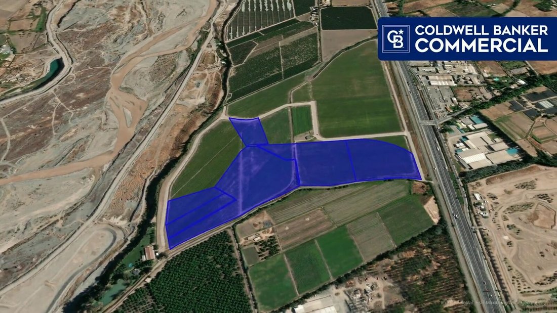
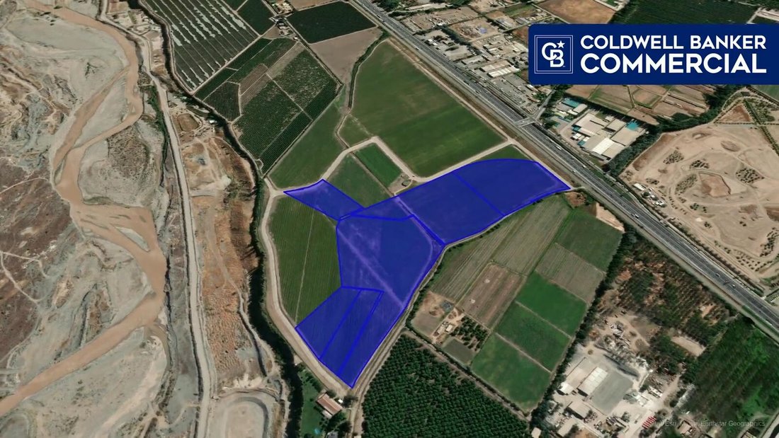
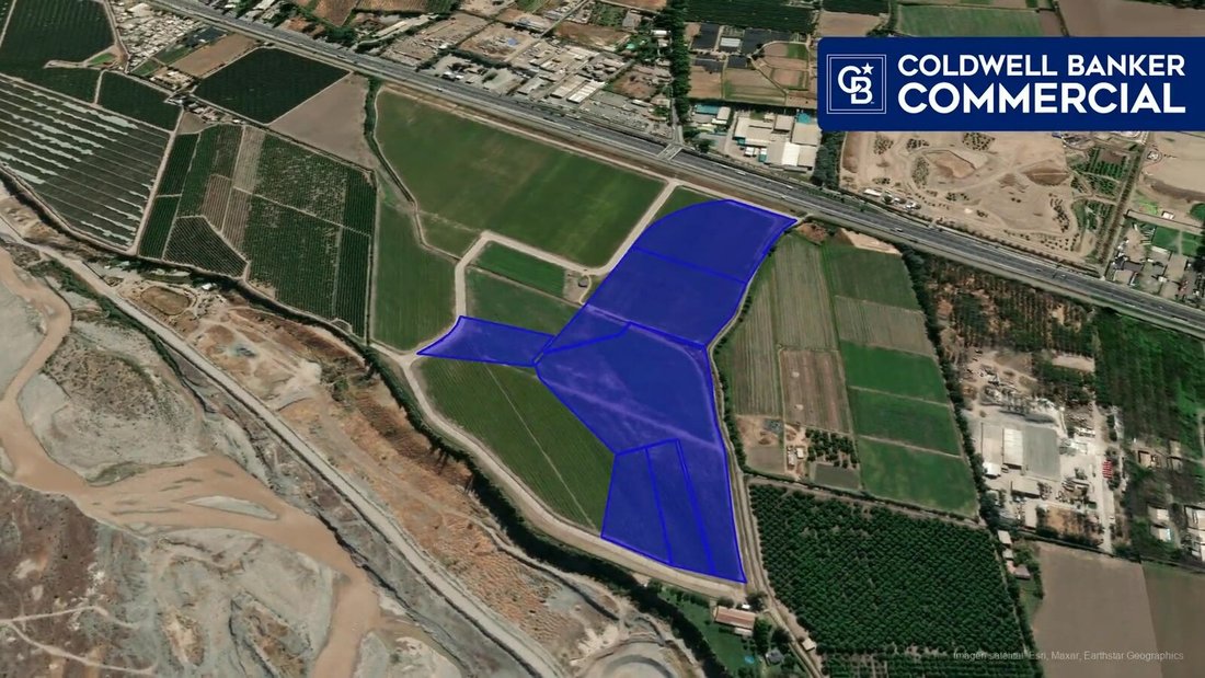
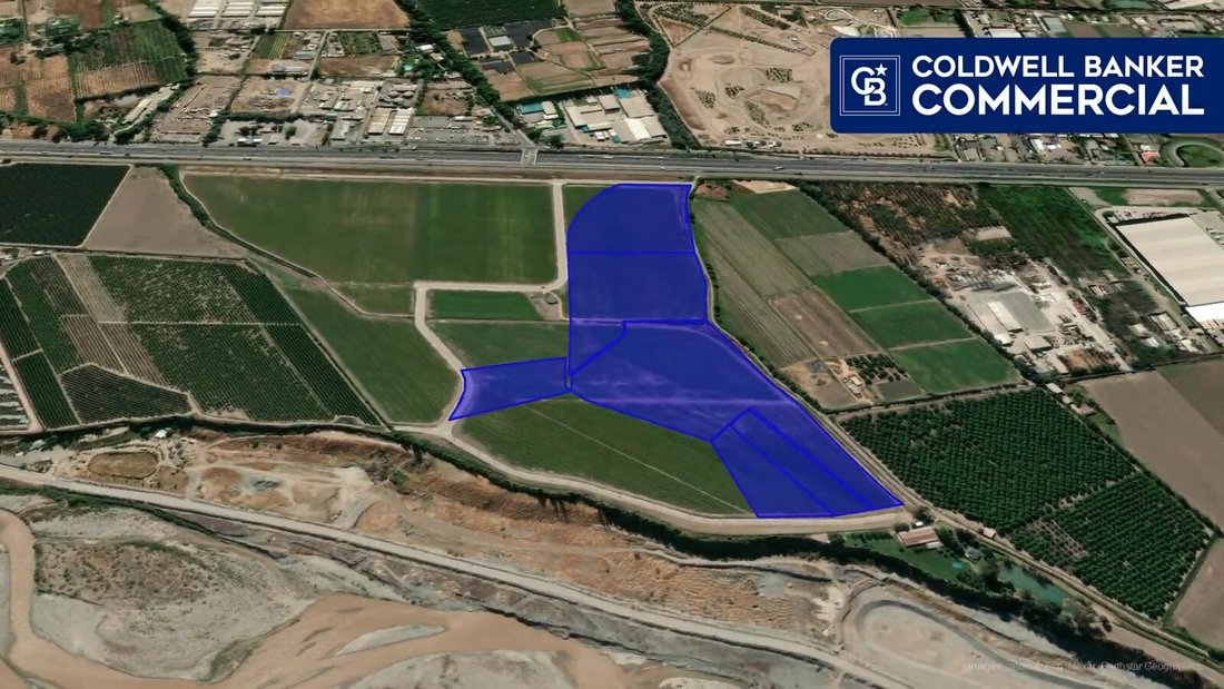
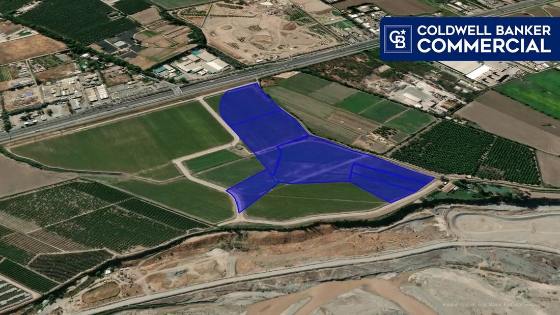
Terreno de 124.524 m² en el sector La Estancilla, Nos, comuna de San Bernardo, dentro del área de crecimiento del sur de Santiago y con acceso a la Ruta 5 y a la red vial metropolitana.
Se ofrece como suelo para desarrollo mixto: residencial, comercial, industrial inofensivo y usos complementarios de vialidad y transporte.
El terreno es plano, de forma regular, sin construccion
Se ofrece como suelo para desarrollo mixto: residencial, comercial, industrial inofensivo y usos complementarios de vialidad y transporte.
El terreno es plano, de forma regular, sin construccion
A 124,524 m² plot of land in the La Estancilla sector of Nos, in the San Bernardo commune, within the southern growth area of Santiago and with access to Route 5 and the metropolitan road network.
It is offered as land for mixed-use development: residential, commercial, low-impact industrial, and complementary uses for roads and transportation.
The land is flat, regularly shaped,
It is offered as land for mixed-use development: residential, commercial, low-impact industrial, and complementary uses for roads and transportation.
The land is flat, regularly shaped,
Terreno de 124.524 m² en el sector La Estancilla, Nos, comuna de San Bernardo, dentro del área de crecimiento del sur de Santiago y con acceso a la Ruta 5 y a la red vial metropolitana.
Se ofrece como suelo para desarrollo mixto: residencial, comercial, industrial inofensivo y usos complementarios de vialidad y transporte.
El terreno es plano, de forma regular, sin construcciones, y viene de un plano de subdivisión que define seis lotes resultantes, lo que permite abordarlo por etapas o transferir lotes individuales en vez de comprometer todo el terreno de una vez.
Destino agrícola según SII, condición habitual en suelo de expansión que aún no cambia de categoría.
Es un banco de suelo de escala poco frecuente a esta distancia de Santiago.
Las normas urbanísticas aplicables y la factibilidad sanitaria por confirmar en el Certificado de Informaciones Previas y con la empresa sanitaria antes de proyectar.
Se ofrece como suelo para desarrollo mixto: residencial, comercial, industrial inofensivo y usos complementarios de vialidad y transporte.
El terreno es plano, de forma regular, sin construcciones, y viene de un plano de subdivisión que define seis lotes resultantes, lo que permite abordarlo por etapas o transferir lotes individuales en vez de comprometer todo el terreno de una vez.
Destino agrícola según SII, condición habitual en suelo de expansión que aún no cambia de categoría.
Es un banco de suelo de escala poco frecuente a esta distancia de Santiago.
Las normas urbanísticas aplicables y la factibilidad sanitaria por confirmar en el Certificado de Informaciones Previas y con la empresa sanitaria antes de proyectar.
A 124,524 m² plot of land in the La Estancilla sector of Nos, in the San Bernardo commune, within the southern growth area of Santiago and with access to Route 5 and the metropolitan road network.
It is offered as land for mixed-use development: residential, commercial, low-impact industrial, and complementary uses for roads and transportation.
The land is flat, regularly shaped, and undeveloped. It comes from a subdivision plan that defines six resulting lots, allowing for phased development or the transfer of individual lots instead of committing the entire property at once.
The land is designated for agricultural use according to the Chilean Internal Revenue Service (SII), a common condition for expansion land that has not yet been reclassified.
This is a rare land bank at this distance from Santiago.
Applicable urban planning regulations and sanitary feasibility must be confirmed in the Certificate of Prior Information and with the water utility company before any planning begins.
It is offered as land for mixed-use development: residential, commercial, low-impact industrial, and complementary uses for roads and transportation.
The land is flat, regularly shaped, and undeveloped. It comes from a subdivision plan that defines six resulting lots, allowing for phased development or the transfer of individual lots instead of committing the entire property at once.
The land is designated for agricultural use according to the Chilean Internal Revenue Service (SII), a common condition for expansion land that has not yet been reclassified.
This is a rare land bank at this distance from Santiago.
Applicable urban planning regulations and sanitary feasibility must be confirmed in the Certificate of Prior Information and with the water utility company before any planning begins.
-
Tipo de propiedad
Terreno
Explorar la zona
La Estancilla, San Bernardo, Región Metropolitana, Chile
Ver en Google Maps
Precio por sqft
Bajo
Alto
Se unió hace 1 año
Usted ha preguntado por esta propiedad
El agente se comunicará con usted pronto por
Publicado por
Coldwell Banker Commercial Chile - Las Condes
Región Metropolitana de Santiago, Chile
Ver perfil de la agencia
29
Anuncios
2025
Se unió
Reserva una visita con the agent
Elija una fecha y si prefiere una visita virtual o presencial con el agente.
Fecha preferida
Tipo de tour

Coldwell Banker Commercial Chile - Las Condes
Av. Alonso de Córdova 5900, Las Condes, Región Metropolitana de Santiago, Chile
Ver perfil de la agencia
Última actualización
Octubre 2
Primera publicación
Septiembre 1
Referencia del anuncio
gzvgd5
Propiedades similares cercanas
Nuevos anuncios en San Bernardo
Explorar más viviendas en venta
San Bernardo, Chile tipos de propiedad
Guías e historias relacionadas
La confianza de los mejores brokers del mundo
Los agentes tras las propiedades más excepcionales del mundo publican en JamesEdition.
- Anuncios de Sotheby's, Christie's, BARNES y Engel & Völkers
- Cada anuncio se revisa antes de publicarse
- Conecte directamente con agentes verificados
Al continuar, acepta nuestros Términos y la Política de Privacidad.