$2,155,361
Fondo Bonanza. Puerto Montt
- Actualizado: Agosto 13
-
8
Vistas de los últimos 30 días
- 9
Sobre la propiedad
La descripción se tradujo automáticamente.
La descripción se muestra en el idioma original.
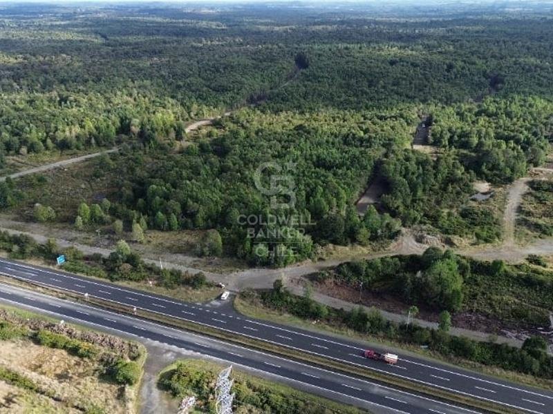
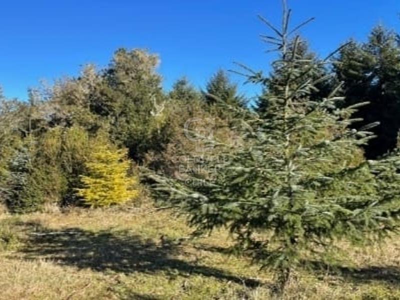
Predio de 165 hectáreas ubicado al costado derecho (norte - sur ) de la doble vía Ruta 5; a 42 km al sur de la capital regional de Puerto Montt y a 13 km al norte del canal de Chacao y fúturo puente que cruzará a la Isla Grande de Chiloé.
Proyecto con subdivisión aprobada e inscrita en el CBR, con cáminos interiores terminados.
Se caracteriza por tener deslindes bien definidos; a
Proyecto con subdivisión aprobada e inscrita en el CBR, con cáminos interiores terminados.
Se caracteriza por tener deslindes bien definidos; a
A 165-hectare property located on the right-hand side (north-south) of the Route 5 dual carriageway; 42 km south of the regional capital of Puerto Montt and 13 km north of the Chacao Channel and the future bridge that will cross to Chiloé Island.
The project has an approved subdivision plan registered with the Land Registry (CBR), and the internal roads are completed.
It is chara
The project has an approved subdivision plan registered with the Land Registry (CBR), and the internal roads are completed.
It is chara
Predio de 165 hectáreas ubicado al costado derecho (norte - sur ) de la doble vía Ruta 5; a 42 km al sur de la capital regional de Puerto Montt y a 13 km al norte del canal de Chacao y fúturo puente que cruzará a la Isla Grande de Chiloé.
Proyecto con subdivisión aprobada e inscrita en el CBR, con cáminos interiores terminados.
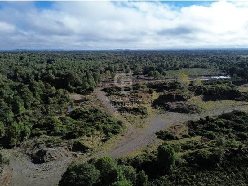
Se caracteriza por tener deslindes bien definidos; al este posee 1.200 mtrs aproximadamente frente a la doble vía y dos riachuelos con caudal permanente todo el año, uno por el norte y otro por el sur del predio.
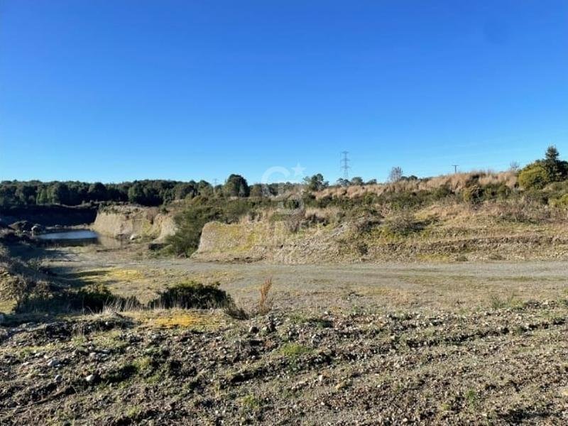
Posee un pozo de áridos de 2 hectáreas, el cual podría ser explotado y aumentado en su tamaño si fuése necesario.
En cuanto a los servicios, cuenta con una línea eléctrica trifásica que va de norte a sur por los 1.200 metros del deslinde este. Esta zona se carácteriza por tener aguas subterráneas con un caudal importante que va desde los 30 metros de profundidad aproximadamente.
El valor de venta es por el predio completo.
Proyecto con subdivisión aprobada e inscrita en el CBR, con cáminos interiores terminados.
Se caracteriza por tener deslindes bien definidos; al este posee 1.200 mtrs aproximadamente frente a la doble vía y dos riachuelos con caudal permanente todo el año, uno por el norte y otro por el sur del predio.
Posee un pozo de áridos de 2 hectáreas, el cual podría ser explotado y aumentado en su tamaño si fuése necesario.
En cuanto a los servicios, cuenta con una línea eléctrica trifásica que va de norte a sur por los 1.200 metros del deslinde este. Esta zona se carácteriza por tener aguas subterráneas con un caudal importante que va desde los 30 metros de profundidad aproximadamente.
El valor de venta es por el predio completo.
A 165-hectare property located on the right-hand side (north-south) of the Route 5 dual carriageway; 42 km south of the regional capital of Puerto Montt and 13 km north of the Chacao Channel and the future bridge that will cross to Chiloé Island.
The project has an approved subdivision plan registered with the Land Registry (CBR), and the internal roads are completed.
It is characterized by well-defined boundaries; to the east, it has approximately 1,200 meters of frontage on the dual carriageway and two streams with year-round flow, one to the north and one to the south of the property.
It has a 2-hectare gravel pit, which could be exploited and expanded if necessary.
Regarding utilities, it has a three-phase power line running north-south along the 1,200 meters of the eastern boundary. This area is characterized by a significant amount of groundwater, reaching depths of approximately 30 meters.
The sale price is for the entire property.
The project has an approved subdivision plan registered with the Land Registry (CBR), and the internal roads are completed.
It is characterized by well-defined boundaries; to the east, it has approximately 1,200 meters of frontage on the dual carriageway and two streams with year-round flow, one to the north and one to the south of the property.
It has a 2-hectare gravel pit, which could be exploited and expanded if necessary.
Regarding utilities, it has a three-phase power line running north-south along the 1,200 meters of the eastern boundary. This area is characterized by a significant amount of groundwater, reaching depths of approximately 30 meters.
The sale price is for the entire property.
-
Tipo de propiedad
Terreno
Características
- Jardín
- Vista a la Montaña
Explorar la zona
Costado derecho de la doble vía Ruta, Puerto Montt, Los Lagos, Chile
Ver en Google Maps
Precio por sqft
Bajo
Alto
Se unió hace 3 años
Usted ha preguntado por esta propiedad
El agente se comunicará con usted pronto por
Publicado por
45
Anuncios
2023
Se unió
Reserva una visita con the agent
Elija una fecha y si prefiere una visita virtual o presencial con el agente.
Fecha preferida
Tipo de tour

Coldwell Banker Los Lagos - Los Lagos
Km 1.5 Camino Ensenada, Los Lagos, Los Lagos, Chile
Ver perfil de la agencia
Última actualización
Agosto 13
Primera publicación
May 31, 2025
Referencia del anuncio
h4d9k6
Propiedades similares cercanas
Nuevos anuncios en Puerto Montt

Explorar más viviendas en venta
Puerto Montt, Chile tipos de propiedad
Puerto Montt, Chile búsquedas populares
- Propiedades Vista al Agua en Puerto Montt, Chile
- Propiedades Vista al Mar en Puerto Montt, Chile
- Propiedades Vista Panorámica en Puerto Montt, Chile
- Propiedades con Chimenea en Puerto Montt, Chile
- Propiedades con Jacuzzi en Puerto Montt, Chile
- Propiedades Frente al Agua en Puerto Montt, Chile
- Propiedades con Sauna en Puerto Montt, Chile
- Propiedades Ecuestre en Puerto Montt, Chile
- Propiedades con Terraza en Puerto Montt, Chile
Guías e historias relacionadas
La confianza de los mejores brokers del mundo
Los agentes tras las propiedades más excepcionales del mundo publican en JamesEdition.
- Anuncios de Sotheby's, Christie's, BARNES y Engel & Völkers
- Cada anuncio se revisa antes de publicarse
- Conecte directamente con agentes verificados
Al continuar, acepta nuestros Términos y la Política de Privacidad.