$8,109,982
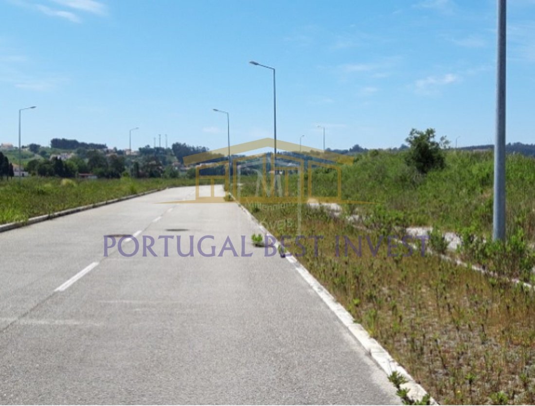
Terreno Con Proyecto Aprobado En Alcobaça Leiria
- 1,635,575 Sqft
- Actualizado: Junio 18
- 2
Sobre la propiedad
La descripción se tradujo automáticamente.
La descripción se muestra en el idioma original.
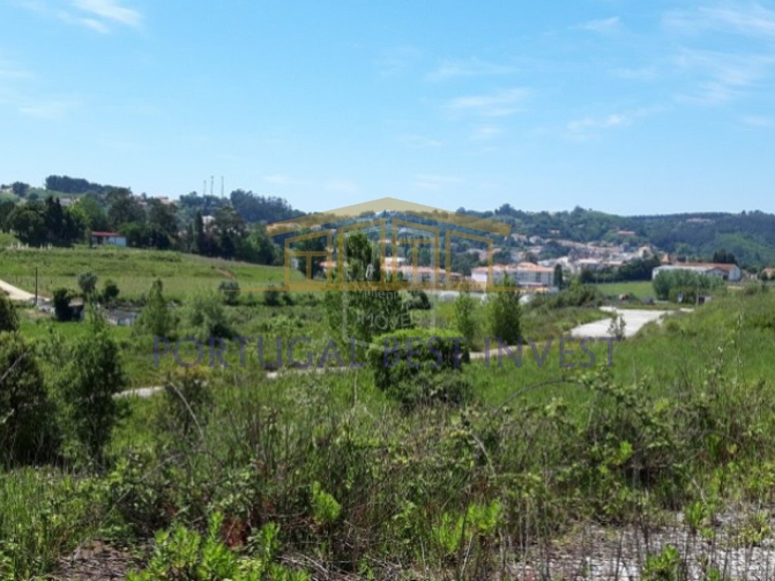
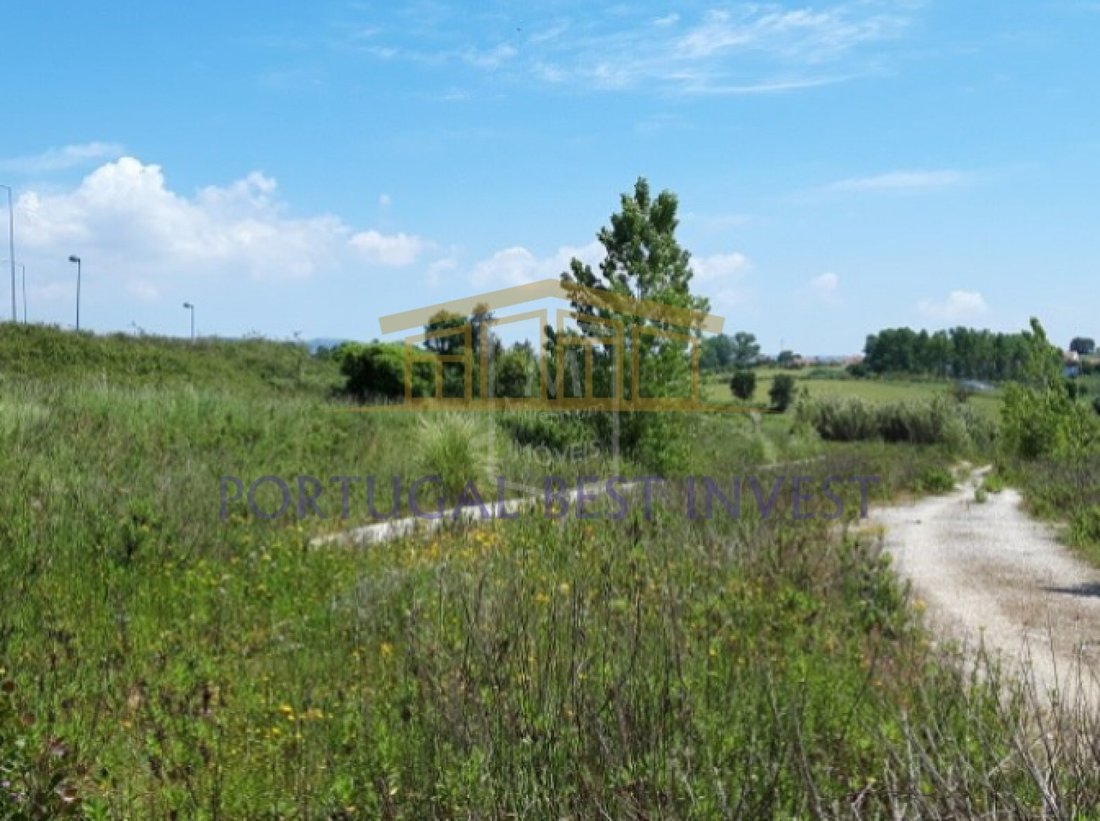
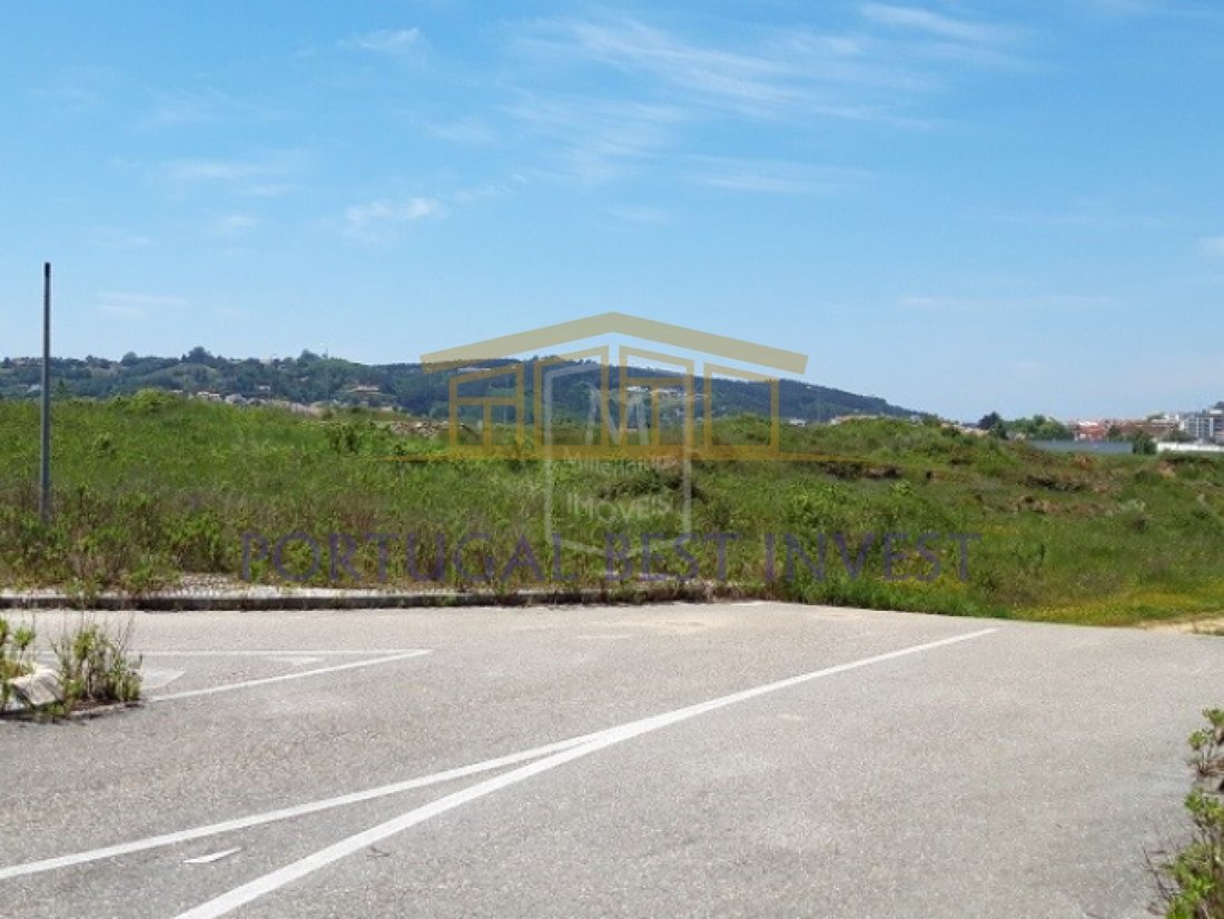
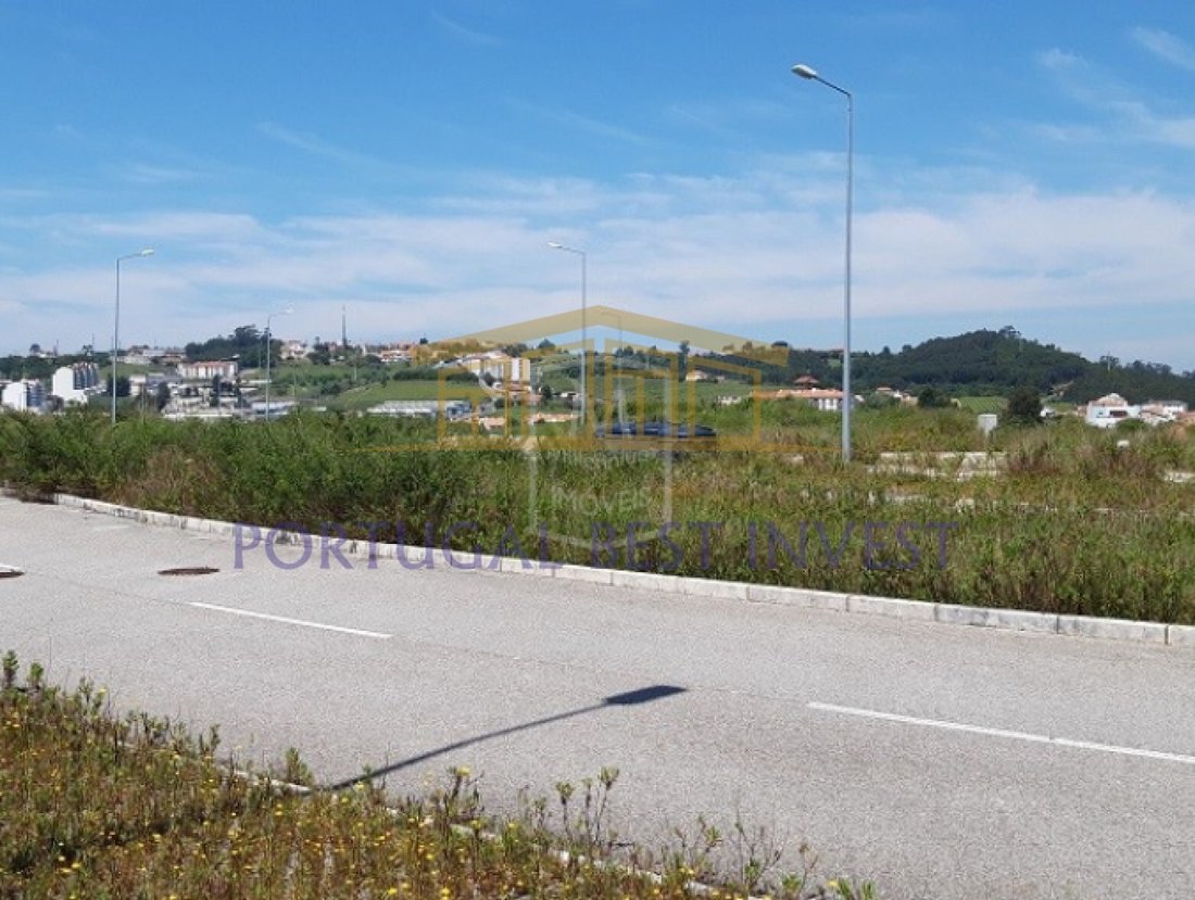
Importante parcela con Alcobaça cuyas obras de urbanización fueron aprobadas por la CMA, para viviendas (unifamiliares y multifamiliares), comercio y servicios, con una superficie bruta total de construcción (ABC) de 151.950m2.
Clase energética: Exento
La actual ciudad de Alcobaça ha crecido en los valles del río Alcoa y el río Baça.
La zona del actual municipio de Alcob
Clase energética: Exento
La actual ciudad de Alcobaça ha crecido en los valles del río Alcoa y el río Baça.
La zona del actual municipio de Alcob
Important allotment with Alcobaça whose urbanization works were approved by the CMA, for housing (single-family and multi-family), commerce and services, with a total Gross Construction Area (ABC) of 151,950m2.
Energy Class: Exempt
The current city of Alcobaça has grown in the valleys of the Alcoa River and the Baça River.
The area of the current municipality of Alcobaça
Energy Class: Exempt
The current city of Alcobaça has grown in the valleys of the Alcoa River and the Baça River.
The area of the current municipality of Alcobaça
Importante parcela con Alcobaça cuyas obras de urbanización fueron aprobadas por la CMA, para viviendas (unifamiliares y multifamiliares), comercio y servicios, con una superficie bruta total de construcción (ABC) de 151.950m2.
Clase energética: Exento
La actual ciudad de Alcobaça ha crecido en los valles del río Alcoa y el río Baça.
La zona del actual municipio de Alcobaça estaba habitada por los romanos, pero la denominación la dejaron los árabes, cuya ocupación denota una era de progreso a juzgar por los numerosos topónimos de las tierras adyacentes que les recuerdan, como Alcobaça, Alfeizerão, Aljubarrota, Alpedriz y otros topónimos.
Cuando se reconquistó Alcobaça, la localidad tenía acceso al mar cercano que formaba la gran laguna de Pederneira que llegaba a Cós y les permitía navegar en las embarcaciones que transportaban al resto del país los deliciosos frutos producidos en la región gracias a la técnica introducida por los monjes de Cisterer. .
Afonso Henriques endulzó las Tierras de Alcobaça a los monjes cistercienses el 8 de abril de 1153, con la obligación de hacerlos eructar; las donaciones hechas a lo largo de los distintos reinados llegaron a constituir un vasto territorio, Los Coutos de Alcobaça, que iba desde São Pedro de Moel hasta São Martinho do Porto y desde Aljubarrota a Alvorninha, y el territorio alcanzó su máximo máximo durante el reinado de D. Fernando I.
Los monjes de Cistermen llegaron a ser señores de 14 pueblos, de los cuales 4 eran puertos marítimos: Alfeizerão, São Martinho do Porto, Pederneira y Paredes da Vitória.
Los monjes de Alcobaça, además de su actividad religiosa y cultural, han tenido clases públicas desde 1269 y en ellas, además de Humanidades, Lógica y Teología, enseñaron técnicas agrícolas, desarrollaron una notable y duradera acción colonizadora, poniendo en práctica las innovaciones agrícolas. experimentada en otros monasterios y gracias a la cual eructaron las tierras, secaron palos, introdujeron culturas adecuadas a cada tierra y organizaron granjas o fincas, lo que llamaron granjas, creando prácticamente de la nada una región agrícola que se ha mantenido hasta nuestros días como una de las más productivas de Portugal . Joaquim Vieira Naatividade se refiere a los monjes de Alcobaça, como los monjes-agrónomos.
Los municipios de Alcobaça y Nazaré, así como parte del municipio norteño de Caldas da Rainha, fueron eructados y administrados por los monjes alcobacenses. Este vasto territorio se llamaba Coutos de Alcobaça.
Calificación energética: exento
#REF: PBI-1253
Clase energética: Exento
La actual ciudad de Alcobaça ha crecido en los valles del río Alcoa y el río Baça.
La zona del actual municipio de Alcobaça estaba habitada por los romanos, pero la denominación la dejaron los árabes, cuya ocupación denota una era de progreso a juzgar por los numerosos topónimos de las tierras adyacentes que les recuerdan, como Alcobaça, Alfeizerão, Aljubarrota, Alpedriz y otros topónimos.
Cuando se reconquistó Alcobaça, la localidad tenía acceso al mar cercano que formaba la gran laguna de Pederneira que llegaba a Cós y les permitía navegar en las embarcaciones que transportaban al resto del país los deliciosos frutos producidos en la región gracias a la técnica introducida por los monjes de Cisterer. .
Afonso Henriques endulzó las Tierras de Alcobaça a los monjes cistercienses el 8 de abril de 1153, con la obligación de hacerlos eructar; las donaciones hechas a lo largo de los distintos reinados llegaron a constituir un vasto territorio, Los Coutos de Alcobaça, que iba desde São Pedro de Moel hasta São Martinho do Porto y desde Aljubarrota a Alvorninha, y el territorio alcanzó su máximo máximo durante el reinado de D. Fernando I.
Los monjes de Cistermen llegaron a ser señores de 14 pueblos, de los cuales 4 eran puertos marítimos: Alfeizerão, São Martinho do Porto, Pederneira y Paredes da Vitória.
Los monjes de Alcobaça, además de su actividad religiosa y cultural, han tenido clases públicas desde 1269 y en ellas, además de Humanidades, Lógica y Teología, enseñaron técnicas agrícolas, desarrollaron una notable y duradera acción colonizadora, poniendo en práctica las innovaciones agrícolas. experimentada en otros monasterios y gracias a la cual eructaron las tierras, secaron palos, introdujeron culturas adecuadas a cada tierra y organizaron granjas o fincas, lo que llamaron granjas, creando prácticamente de la nada una región agrícola que se ha mantenido hasta nuestros días como una de las más productivas de Portugal . Joaquim Vieira Naatividade se refiere a los monjes de Alcobaça, como los monjes-agrónomos.
Los municipios de Alcobaça y Nazaré, así como parte del municipio norteño de Caldas da Rainha, fueron eructados y administrados por los monjes alcobacenses. Este vasto territorio se llamaba Coutos de Alcobaça.
Calificación energética: exento
#REF: PBI-1253
Important allotment with Alcobaça whose urbanization works were approved by the CMA, for housing (single-family and multi-family), commerce and services, with a total Gross Construction Area (ABC) of 151,950m2.
Energy Class: Exempt
The current city of Alcobaça has grown in the valleys of the Alcoa River and the Baça River.
The area of the current municipality of Alcobaça was inhabited by the Romans, but the denomination was left to it by the Arabs, whose occupation denotes an era of progress judging by the numerous toponyms of the adjacent lands that remind them, such as Alcobaça, Alfeizerão, Aljubarrota, Alpedriz and other toponyms.
When Alcobaça was reconquered, the locality had access to the nearby sea that formed the great Pederneira Lagoon that reached Cós and allowed them to sail the vessels that transported to the rest of the country the delicious fruits produced in the region thanks to the technique introduced by the monks of Cisterer.
Afonso Henriques sweetened the Lands of Alcobaça to the Cistercian monks on April 8, 1153, with the obligation to burp them; the donations made over the various reigns came to constitute a vast territory - The Coutos of Alcobaça - ranging from about São Pedro de Moel to São Martinho do Porto and from Aljubarrota to Alvorninha, and the territory reached its maximum in the reign of D. Fernando I.
The monks of Cistermen came to be lords of 14 villages of which 4 were sea ports: Alfeizerão, São Martinho do Porto, Pederneira and Paredes da Vitória.
The monks of Alcobaça, in addition to their religious and cultural activity- have had public classes since 1269 and in them, in addition to Humanities, Logic and Theology, taught agricultural techniques - developed a remarkable and lasting colonizing action, putting into practice the agricultural innovations experienced in other monasteries and thanks to which they burped the lands, dried sticks, introduced cultures suitable to each land and organized farms or farms, what they called farms, creating practically from nothing an agricultural region that has remained to this day as one of the most productive in Portugal. Joaquim Vieira Naatividade refers to the monks of Alcobaça, as the monks-agronomes.
The municipalities of Alcobaça and Nazaré, as well as part of the northern municipality of Caldas da Rainha, was burped and administered by the Alcobacense monks. This vast territory was called the Coutos de Alcobaça.
Energy Rating: Exempt
#ref:PBI-1253
Energy Class: Exempt
The current city of Alcobaça has grown in the valleys of the Alcoa River and the Baça River.
The area of the current municipality of Alcobaça was inhabited by the Romans, but the denomination was left to it by the Arabs, whose occupation denotes an era of progress judging by the numerous toponyms of the adjacent lands that remind them, such as Alcobaça, Alfeizerão, Aljubarrota, Alpedriz and other toponyms.
When Alcobaça was reconquered, the locality had access to the nearby sea that formed the great Pederneira Lagoon that reached Cós and allowed them to sail the vessels that transported to the rest of the country the delicious fruits produced in the region thanks to the technique introduced by the monks of Cisterer.
Afonso Henriques sweetened the Lands of Alcobaça to the Cistercian monks on April 8, 1153, with the obligation to burp them; the donations made over the various reigns came to constitute a vast territory - The Coutos of Alcobaça - ranging from about São Pedro de Moel to São Martinho do Porto and from Aljubarrota to Alvorninha, and the territory reached its maximum in the reign of D. Fernando I.
The monks of Cistermen came to be lords of 14 villages of which 4 were sea ports: Alfeizerão, São Martinho do Porto, Pederneira and Paredes da Vitória.
The monks of Alcobaça, in addition to their religious and cultural activity- have had public classes since 1269 and in them, in addition to Humanities, Logic and Theology, taught agricultural techniques - developed a remarkable and lasting colonizing action, putting into practice the agricultural innovations experienced in other monasteries and thanks to which they burped the lands, dried sticks, introduced cultures suitable to each land and organized farms or farms, what they called farms, creating practically from nothing an agricultural region that has remained to this day as one of the most productive in Portugal. Joaquim Vieira Naatividade refers to the monks of Alcobaça, as the monks-agronomes.
The municipalities of Alcobaça and Nazaré, as well as part of the northern municipality of Caldas da Rainha, was burped and administered by the Alcobacense monks. This vast territory was called the Coutos de Alcobaça.
Energy Rating: Exempt
#ref:PBI-1253
-
Tipo de propiedad
Terreno
-
Precio/pie²
$4
-
Emisiones
NI
-
Consumo
X
Características
Explorar la zona
Alcobaca e Vestiaria, Distrito de Leiria, Portugal
Ver en Google Maps
Precio por sqft
Bajo
Alto
Se unió hace 7 años
Usted ha preguntado por esta propiedad
El agente se comunicará con usted pronto por
Publicado por
68
Anuncios
2020
Se unió
Reserva una visita con the agent
Elija una fecha y si prefiere una visita virtual o presencial con el agente.
Fecha preferida
Tipo de tour
Última actualización
Junio 18
Primera publicación
Octubre 9, 2022
Referencia del anuncio
PBI-1253-0519578524
Propiedades similares cercanas
Nuevos anuncios en Alcobaca e Vestiaria


Explorar más viviendas en venta
Alcobaca e Vestiaria, Distrito de Leiria, Portugal tipos de propiedad
- Casas adosadas en venta en Alcobaca e Vestiaria, Distrito de Leiria, Portugal
- Casas en venta en Alcobaca e Vestiaria, Distrito de Leiria, Portugal
- Terreno en venta en Alcobaca e Vestiaria, Distrito de Leiria, Portugal
- Apartamentos en venta en Alcobaca e Vestiaria, Distrito de Leiria, Portugal
- Ranchos en venta en Alcobaca e Vestiaria, Distrito de Leiria, Portugal
- Villas en venta en Alcobaca e Vestiaria, Distrito de Leiria, Portugal
Alcobaca e Vestiaria, Distrito de Leiria, Portugal búsquedas populares
- Propiedades Vista Panorámica en Alcobaca e Vestiaria, Distrito de Leiria, Portugal
- Propiedades Vista al Mar en Alcobaca e Vestiaria, Distrito de Leiria, Portugal
- Propiedades con Terraza en Alcobaca e Vestiaria, Distrito de Leiria, Portugal
- Propiedades con Bar en Alcobaca e Vestiaria, Distrito de Leiria, Portugal
- Propiedades con Sala de juegos en Alcobaca e Vestiaria, Distrito de Leiria, Portugal
- Propiedades con Oficina en Alcobaca e Vestiaria, Distrito de Leiria, Portugal
- Propiedades con Ascensor en Alcobaca e Vestiaria, Distrito de Leiria, Portugal
- Propiedades Vista de la ciudad en Alcobaca e Vestiaria, Distrito de Leiria, Portugal
- Propiedades Vista a la Montaña en Alcobaca e Vestiaria, Distrito de Leiria, Portugal
- Propiedades con Jardín en Alcobaca e Vestiaria, Distrito de Leiria, Portugal
- Propiedades con Cocina exterior en Alcobaca e Vestiaria, Distrito de Leiria, Portugal
- Propiedades Frente al mar en Alcobaca e Vestiaria, Distrito de Leiria, Portugal
- Propiedades Comunidad Cerrada en Alcobaca e Vestiaria, Distrito de Leiria, Portugal
- Propiedades Privacidad en Alcobaca e Vestiaria, Distrito de Leiria, Portugal
- Propiedades Frente al Agua en Alcobaca e Vestiaria, Distrito de Leiria, Portugal
- Propiedades Cima de una colina en Alcobaca e Vestiaria, Distrito de Leiria, Portugal
- Propiedades Propiedad de Inversión en Alcobaca e Vestiaria, Distrito de Leiria, Portugal
- Propiedades Moderno en Alcobaca e Vestiaria, Distrito de Leiria, Portugal
- Propiedades Ecuestre en Alcobaca e Vestiaria, Distrito de Leiria, Portugal
- Propiedades Obras nuevas en Alcobaca e Vestiaria, Distrito de Leiria, Portugal
- Propiedades con Gimnasio en Alcobaca e Vestiaria, Distrito de Leiria, Portugal
- Propiedades con Sauna en Alcobaca e Vestiaria, Distrito de Leiria, Portugal
- Propiedades con Biblioteca en Alcobaca e Vestiaria, Distrito de Leiria, Portugal
- Propiedades con Aire Acondicionado en Alcobaca e Vestiaria, Distrito de Leiria, Portugal
- Propiedades Frente al Mar en Alcobaca e Vestiaria, Distrito de Leiria, Portugal
- Propiedades con Jacuzzi en Alcobaca e Vestiaria, Distrito de Leiria, Portugal
- Propiedades con Chimenea en Alcobaca e Vestiaria, Distrito de Leiria, Portugal
- Propiedades con Piscina en Alcobaca e Vestiaria, Distrito de Leiria, Portugal
- Propiedades con Garaje en Alcobaca e Vestiaria, Distrito de Leiria, Portugal
- Propiedades con Balcón en Alcobaca e Vestiaria, Distrito de Leiria, Portugal
- Propiedades con Cancha de Tenis en Alcobaca e Vestiaria, Distrito de Leiria, Portugal
- Propiedades Frente al mar en Alcobaca e Vestiaria, Distrito de Leiria, Portugal
- Propiedades con Cocina abierta en Alcobaca e Vestiaria, Distrito de Leiria, Portugal
- Propiedades Renovado en Alcobaca e Vestiaria, Distrito de Leiria, Portugal
- Propiedades Vista al Agua en Alcobaca e Vestiaria, Distrito de Leiria, Portugal
Guías e historias relacionadas
La confianza de los mejores brokers del mundo
Los agentes tras las propiedades más excepcionales del mundo publican en JamesEdition.
- Anuncios de Sotheby's, Christie's, BARNES y Engel & Völkers
- Cada anuncio se revisa antes de publicarse
- Conecte directamente con agentes verificados
Al continuar, acepta nuestros Términos y la Política de Privacidad.